Tuesday, May 31, 2011

Howick-Ormstown-Huntingdon-Ste-Chrysostome bike path developments


Yellow = new rail-to-trail bike path(s), red = existing bike paths

The MRC de Haut St-Laurent (which is the french name for the Chateauguay Valley) has announced the go-ahead for this rail-to-trail bike path(s) in the Chateauguay Valley:

The old railway line will be spruced up and its vocation recycled.

Bicycle lovers, check your derailleur gears, grease your chains, shine up your steed!! The Haut-Saint-Laurent is setting up a bicycle path that will take you around the country.

The MRC du Haut-Saint-Laurent has signed a lease with de Ministry of Transportation for all disused railway corridors on its territory. These corridors will become a bike path.

This project will be implemented in three phases:
Phase 1: Howick - Ormstown is scheduled for Fall 2011.
Phase 2: Howick - Saint-Chrysostome is scheduled for Fall 2012 / Spring 2013
Phase 3: Ormstown - Godmanchester is scheduled for Fall 2013 / Spring 2014.

Financial details will be announced later since the portion of government funding is not confirmed.

Regarding the rules of use, we know at this stage that quads will not be allowed on the bike path. Regarding skidoos, negotiations will take place.

Landowners neighboring the railway corridors will be notified by the Ministry of Transportation regarding their rights and duties.

More information will follow as the project develops.

CONTEST

The MRC du Haut-Saint-Laurent will soon be launching a major contest in the schools and among the population in order to find a name for the bicycle path. Details of the contest will be posted shortly on the MRC website and in the newspapers. Don’t miss this opportunity to leave your mark…


This seems to link together the two existing railroad rights-of-way: Howick - Huntingdon and Howick - Ste-Chrysostome. Put antother way, it links and extends (in a big way) the two existing regional bike paths Sentier du Paysan (Lacolle-Ste-Chrysostome) and Ste-Martine-to-Howick (this path is presently named "LA PISTE CYCLABLE SAINTE-MARTINE/BEAUHARNOIS, and is part of the Reseau cyclable de la MRC Beauharnois/Salaberry.

This is good and exciting news.

If the path is built as described in the announcement, then it will connect the two existing regional bike paths together. Then this path will run southeast for as much as 50 km.

The route paralleling the Chateauguay river will extend the 7 km existing Ste-Martine bike path ( 7 km from Ste-Martine to outside-Howick where it ends abruptly and unhappily at Rt 203). Finally it gets extended! To Huntingdon is 35 km and it could go 20 km after that into the wilds of Godmanchester. (where our mom was born) To ease the making of signs, I suggest they go the 5 km further into the easier-to-spell Dundee.

This path will go the entire way through the Chateauguay Valley. Starting in Ste-Martine it will go southeast through Howick, Brysonville/Allan's Corners, Ormstown, Dewittville, Huntingdon and beyond to the wilds of Dundee.

The surprise is that this path will connect to the most-unknown bike path in Quebec, the Sentier du Paysan (it is not even on the Monteregie tourist office's map of Monteregie bike paths. The connection to Howick gives this path a much better "official starting point." Recent work at the east end of this path means this path now goes all the way past Lacolle right to the Richelieu river! This is getting seriously amazing. You can ride bike path from Howick to Lacolle, then north along the Richelieu river and then the Chambly Canal bike path. This is one amazing week or weekend bike ride, leave the car behind and bike the entire loop from your doorstep in Montreal.

This fills in a big gap in the bike-path network that existed in the south and southwest Monteregie.


Tuesday, May 24, 2011

Very southern Monteregie ride - Sentier de Paysan, Lacolle, Covey Hill loop


An almost 100 km ride. Go over the Richelieu on the 202 bridge to bring it over 100km

Clockwise from highest point on ride loop:
  • Sentier des Paysan (paved bike path)
  • The Axe cyclable Vallée-des-Forts on the right side (shared country road)
  • Follow the canadian side of the Canada-US border westwards for a long time
  • Until you ride up to the top of Covey Hill until Stevensons sideroad
  • Zoom downhill back to the start at left side of map.

Get the map on Bikely: click here.


Winds were 50 km/h gusting to 70 km/h, luckily from the side

You can get the two Montérégie cycling maps here at the Montérégie tourism website.

Note that the Sentier de Paysan in southern Montérégie is now extended east past Lacolle to Route 223, making a big loop ride from Montreal with the Axe cyclable Vallée-des-Forts much easier. (it will be easier still when the Pont Mercir finishes building its much-improved replacement bike sidewalk (note the Pont Mercier bridge is presently closed to bikes/pedestrians).


This is one serious new railroad crossing. I think they want us to pay attention.


Larch (tamarack, meleze), the "evergreen" that isn't, is growing its needles for 2011.


This weekend is traditionally a great one for apple blossoms.


Historic Odelltown church, built in 1827.


How historic is the Odelltown church? Those are horse sheds behind the church!


Riding south, not supposed to be beside the river but the flooding changed that a bit.


The Richelieu river was at a historic high level on the weekend.


Hmmm. That road looks... kinda flooded.


OK, it's crossable. But by bike?


We have to decide: do we get the shoes wet or not?


Not.


Hmmm, not cold at all. But definitely wet.


This ride has only one hill, just one. The famous Covey Hill.


The bottom part of the ride's loop is directly along the US-Canada border.

Friday, May 20, 2011

Photos St-Jean-de-Matha to Ste-Emilie-de-L'Energie to Ste-Beatrix ride


Edible fauna abound throughout Lanaudiere.


Rang St-Guillaume always impresses us as the best end-of-ride let's ride 10 km more detour ever.


This recumbent passed us but didn't even say hello.


Three entrances to this park, two of the entrances are visited on the bike ride.


Top of the Rang Ste-Catherine hill, scenic lookout just to right of this photo.


Lots of spring splendor in the northern lanaudiere yesterday. Lots of major new asphalt too!

This ride is highly recommended for both soft and hardcore hill junkies.

If you can ride Camelien Houde a couple of times, you'll have no problem doing this ride.


Crossing the Riviere Noire to get to Chemin de Belle Montagne

We love Chemin de Belle Montagne.


New asphalt on Ste-Emilie-de-L'Energie's Chemin Feuille de l'Erable climb.

This is a sustained, but not too long climb. Nothing too crazy steep. And from the top is one of the great descents. You zoom zoom for a long time.


Spring's colour palette of greens.


New pavement on Chemin Rang Ste-Catherine climb.

This climb is memorable. And at the top is one of the greatest scenic-outlook rest stops you'll ever be glad to stop at.


Looking back to St-Jean-de-Matha from first climb at edge of town.


If you take the Rang St-Guillaume option at the ride's end you also arrive back here at end of ride. We really recommend finishing the ride with Rang St-Guillaume.

Yet more new asphalt is found on the Chemin Pied de Montagne. This really spices up the ride after Ste-Beatrix as this gives you a second side road to zig and zag back to St-Jean-de-Matha.

Map here on the ever-slow bikely website. (Bikely needs new servers real bad)


This is one of our favorite rides EVER.

Note the three little highly scenic and fun additions at the end of the ride compared to the map in the post below.

These are:
  • Chemin pied de montagne
  • Cul de sac road to St-Jean-de-Matha entrance of Parc Regional des chutes
  • Rang St-Guillaume

Labels:

Time for St-Jean-de-Matha hills ride


65km of paradise. Many excellent hills are included at no additional cost.

Check out many photos of our previous Lanaudiere rides here.

Spring hasn't been the greatest in 2010, but today the sky is blue and the temperature is rising.

By now we've ridden every Chateauguay valley road, so it's time to return to another of our favorite destinations: St-Jean-de-Matha in the northern Lanaudiere. Northern Lanaudiere is kind of the eastern Laurentians, but with better roads.

The circuit is St-Jean-de-Matha - warmup loop east of town - little hill north to amazing scenic lookout - downhill to Ste-Emilie de l'Energie - go south up big hill feuille de l'erable to chemin de Belle Montagne - which is a super scenic road all the way to to Ste-Beatrix - to bridge beside big waterfall at Parc Regional des chutes de quelque chose by the back road - highway (with paved shoulders) back to the car. (you can reverse the Belle Montagne road if you want a longer ride here).

Unlike the Chateauguay valley, where almost any road is a great cycling road, in Lanaudiere we stick to this specific ride which we use as a base for a ride with many distance options, but today is the basic ride. This ride is so good, we do it again, and again, and again. It has the all the important essences of a great ride - and it is essential that you go and ride here!

The circuit is only 65 km, but you can add a southern loop to the ride to add 40 or 50 km. You know, for a full afternoon's ride. And by afternoon we mean until the time when we see the sun set as we get back to the car. (actually, this is a good thing.)

Where is Lanaudiere? It starts at the eastern tip of Montreal Island. It's that's close. Not far. No sir. Do it.


Go east on the 40, go north past Joliette. A mere 70 minutes from Montreal.

Where to park? Park behind city hall (across from church). This is the site of the Louis Cyr Museum, and has washrooms. (note: we've heard this museum may move to a new location in the future)

We like our St-Jean-de-Matha / Ste-Emilie-de-l'Energie / Ste-Beatrix ride because:
  • good distance
  • good hills
  • The two long hills have good descents after the summit is reached
  • good scenery
  • good scenic lookouts, one with benches (northbound top of hill to ste-emilie)
  • good roads (mostly)
  • quiet roads
  • 97 km from Mtl car distance, not so far
  • undeveloped area (no tims, macDo, other corporate crap)
  • the ride is made up of many short sections
  • many options exist to increase ride distance
  • easy to abort - many places you can call it quits and get quickly back to car
  • Good descents
  • No jerkin' around with flats until the hills finally arrive (first 20% hill
  • at 4 minutes into the ride)
  • The two highways part of the ride both have paved shoulders.
  • There's a raspberry farm at foot of one of the major climbs - Yum!
  • There's annual repairs/rebuilding to the roads of this ride
  • You feel like a tour de france mountain stage survivor by ride's end (and not one of those front-of-the-pack guys)
  • You can leave Montreal at 2 pm and still have time for a ride... thanks to summer's late sunsets.

Add it up and you see why we think this is one of the best road rides around.

Check out many photos of our previous Lanaudiere rides here.

Thursday, May 19, 2011

Veloroute des Bleuets 256 km route around Lac St-Jean now 100% asphalt

The Veloroute des Bleuets 256 km bike route around Lac St-Jean is now 100% asphalt.

Maybe this is the year we ride it?

For more information, go here.

World's strangest bike fender?


Another outside-the-box WTF.


This one seems more traditional.

bike haters and anti-tax fetishists fill Gazette's op-ed page

People with poor math, reading, and business-finance skills filled the Gazette's letters to the editors page today.

Too funny!

Wednesday, May 18, 2011

Quebec Trails Day - we need you to volunteer on June 4

June 4 is Quebec Trails day.

The ADSVMQ needs a few people (people just like you) on Saturday June 4 to build and maintain mountain bike trails. These trails don't build themselves.

Besides making the Quebec trail situation even better, volunteering has other side effects. It causes happiness. And did you know that volunteers get 17% fewer flat tires?

Lots more information on how you can volunteer at the Association pour le Développement des Sentiers de Vélo de Montagne au Québec's website ADSVMQ.

the bixi letter

We received this letter from Bixi about the recent headlines.


BIXI. Establishing the facts.

Letter to members and BIXI users

In the past days, much has been said about BIXI that does not correspond to the reality. Therefore it seems essential to restore the facts, particularly now that the plan proposed by the City was finally well-received by the Ministry of Municipal Affairs after more than five months of delay and waiting. The following serves as a clarification regarding some of the allegations which have been circulating in the media.

“BIXI is a financial disaster and is not profitable”: FALSE. BIXI experienced a liquidity problem which was the direct result of a five-month wait for the approval by the Municipal Affairs Minister of its agreement with the City of Montreal. BIXI is a company which experienced rapid growth and realized, after only 2 years, volumes of some $50 million. BIXI also posted results that were 40% greater than the projected budget, thanks in large part to the successful expansion of its system internationally. BIXI does not have a profitability problem nor is BIXI a financial disaster in any way.

“The Montreal operation of BIXI is not profitable”: TRUE. From the beginning, the business plan projected that the Montreal operation of the system would not derive profits in the first years of operation. The plan also indicated that operational costs would be covered once BIXI reached 50,000 members and with the involvement of sponsorship. Proud of the 30,000 members at the end of 2010, we have currently exceeded the level of 40,000 members after only one month of operation in our new 2011 season.

“Montreal is absorbing the BIXI debt”: FALSE. The City gives no money to BIXI. Montreal advanced a loan to BIXI. The initial loan to BIXI in the amount of $37 million is repayable with interest. This loan was accorded to cover conceptualization costs of the system, the patents, the manufacturing and delivery of the components (bikes and stations), the operation losses of the first years as well as the start up costs. This loan is presently owed to Stationnement de Montréal.

“The city is giving $108 million to BIXI”: FALSE. Let us take the time to properly understand the numbers that make up the whole.

$37 million : this amount is a loan to BIXI repayable with interest. The remaining $71 million, guaranteed by the City of Montreal, is comprised of a financing package negotiated with the National Bank subsequent to a tender notice.

It consists of a revolving line of credit of $6 million, as is standard for all businesses; a letter of credit facility up to $5 million for deposit guarantees for all public offerings which is a standard practice with the guarantees rescinded after the process.

A factoring facility up to $60 million offered by the Bank to finance accounts receivable which allows for the necessary liquidity to pay our suppliers while waiting for the cities with whom we do business to effect the payment of our invoices. This facility can only be used when a contract is signed by a city in good and due form.

“Montrealers are financing the export of the BIXI system to other markets”: FALSE. It is, in fact, the contrary. Montrealers fully benefit from the export of the BIXI system to other markets. Last year, it is the successes of the sales of BIXI ($8.5 million) on the international scale that covered the operational deficit of Montreal ($7 million). In this way, we were able to achieve a surplus of $1.5 million and offer a quality system to Montrealers.

“We have a luxurious bike costing $7,400 compared to Barcelona with a bike costing $75”: FALSE. BIXI does not cost $7,000, no more than it costs $3,500, heard on television. The Barcelona bike does not cost $75. The Barcelona bike costs more than 600 €, basically the same cost of our bike. How could we sell with such success on three continents if the bike costs so much? The Montreal bike is likely the most solid and best conceived bike in the world. Its reliability is greater than the bikes currently used in other cities.

“BIXI employs 450 people”: FALSE. . BIXI employs 50 people and has created more than 400 employees at different suppliers everywhere in the region for the manufacturing of the diverse components of the system.

Our business plan is clear. It has been presented publicly. We remain in line with the business plan and once again count on respecting these objectives again this year. The plan outlines clearly that the system will cost nothing to Montrealers. This is our commitment.

By Roger Plamondon, Chairman of the Board of Directors, Public Bike System Company

Sunday, May 15, 2011

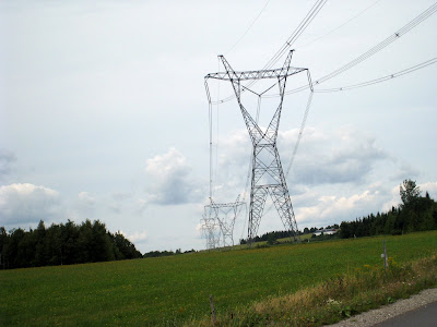
East Hereford's super-scenic mountain bike paradise about to be destroyed by Hydro-Quebec mega-towers to export electricity to US?


Lots of scenery and no Hydro towers...yet


Beautiful rural scenery..... destroyed by our masters at Hydro-Quebec


The Gazette reported this weekend about a protest ("Hands across the border") by citizens on both sides of the US-Canada border about a new electricity transmission line that will pass through the mountain bike paradise of East Hereford. The road biking around here is pretty good too.

Hydro-Quebec, well known for it's scenery-destroying mania to build power transmission lines EVERYWHERE, is finally having to confront some citizens less easy to ignore than us Quebecois. Yes, noisy Americans, bless their hearts, don't want their scenic state scenery spoiled by a hideous electricity transmission towers.

Premier Charest's new "Plan Nord" to flood yet more areas the size of France so we can export electricity to power-hungry yanks depends on passive citizenry meekly accepting their local scenery being destroyed.

It looks likely that the route through New Hampshire will change due to citizen protests. No such luck here in Quebec. Hydro-Quebec rules this province and citizen voices about power transmission corridors do not affect the decision-making process at Hydro-Quebec.

Just say no to destroying this beautiful corner of Quebec.


Hydro towers don't add much to the tourism appeal of our beautiful countryside

Saturday, May 14, 2011

65km Ste-Martine to near-Hemmingford ride


Will we ever get tired of riding through fields and forests?


65 km is a nice distance. Not too short, not too long, Just right really for a active-recovery day kind of ride.

We chose to ride from Ste-Martine with a poorly defined destination of southeast in the Hemmingford direction. We knew the first 1/3 of the ride, and we knew the last 1/3 of the ride, but what was in the middle we knew nothing about. Mainly because we rode right off the edge of our map for the resEAU cyclable du Suroit.

But we weren't worried. We had quiet country roads, a good sense of direction, even a bit of bike path (the very unknown La Sentier du Paysan).

It was also the first hot day of the 2011 year.

The end result is that we went as far as the delightfully named Backbush road, and got home before sunset.

Here's the link to the map on bikely.

Summary: Just another nice country-road ride. Easy distance, easy terrain, but a few little hills to keep it interesting. You could visit hemmingford on this ride, and this is what we will do next time.

Ice cream is available in Ste-Chrysostome if you need a bit of refreshment to make it back to the car in hot temperatures. We can't recommend this enough.


A nice southeast loop from Ste-Martine.

There are a lot of route options when you start in Ste-Martine. From super-short and flat bike paths, to easy road rides, and you can extend these road rides to all distances from 15 to 150 kilometres. The special thing is that there is not one Tim Hortons or other korporate krap anywhere on these rides. (Not yet, so get here soon!)

Rainy Day...

What to do on a rainy day?

How about a birthday party for montreal's newest 100 year old?

Ok, but what about the rest of you?

Might we suggest that it is time to fantasize about summer, and riding the hills of Quebec. Some hills are bigger, and steeper than others, and the Charlevoix has the most and the biggest hills that we know of.

Some of these hills are so steep, that we are afraid to even look at them. Yes, it's true! We've done a bunch of Charlevoix hills, but the steepest one is at St-Joseph de la Rive, chemin cote a godin, and it's 20% steep. Once we went to the bottom of and dared not look up. For we knew that we were not yet worthy of such a hill.

We have reached kind of a stalemate with this hill. We knew it was steep, but we knew nothing else, and were afraid to find out more... and double afraid to try the hill and fail, and have to walk up it. (NO!) Yes, we are kind of hoping we get a bike with even lower gears than the Bert, but that plan was going nowhere fast.

But today we lost our fear of this hill and soon, mere weeks from now, we are going to go to this hill.

From where did this inspiration come from?

From watching a youtube video of one of the most improbable descents we've ever seen: a bigwheel descent.You sort of have to see it to believe it, so we suggest you do exactly that.

Click here now to see a descent of Cote a Godin that you'll never want to do yourself, but you are glad to know "can" be done.

Wednesday, May 11, 2011

Perfect weather for bike commuting has arrived

It's easy to ride your bike to work.

It's even easier to avoid doing it!

Here's our tips for bike commuting, or vélo boulot as they say en français.

  1. Get everything ready the night before. (EVERYTHING!!!!)
  2. Be aware that car drivers are not at their best first thing in the morning. They will do lots of stupid and dangerous things that can kill cyclists. So ride extra safe in traffic. HIGH VISIBILITY cycling clothing is safer. As is riding safely and predictability in traffic.
  3. Ride mellow to work so you don't get that (Madison avenue-driven) need to shower when you get to work.
  4. Bring the correct key for the lock you are using. Doh!
  5. Identify which intersections are extra-dangerous and use extra caution.
  6. Start to begin to think about pondering the creation of an idea in your mind about sort of obeying red lights and stop signs. Don't do things where, if you were watching the situation, you would say "Hey look at THAT idiot!" Admit to yourself that yes, there are some intersections where it is just a simple fact that I have to stop here and wait a minute.
And for gods sake oil your chain and put some air in the tires.


Update: On commuting day 3 we forgot the key for the lock we keep at work. Heck, we know we're not perfect, just fun.

Tuesday, May 10, 2011

la Presse reveals Montreal's 2011 cycling infrastructure projects

Yes, La Presse is hard at work printing advance copies of press releases from the city of Montreal. They reveal that there will be 50 km of additions to the Montreal island bike path network.

Additions to the bike path network for 2011:
  • a new route north on Berri and Lajeunesse north of Castelnau to Gouin. But no word on the non-street Route Verte bike path route north along the CP train tracks.
  • Extension of the downtown de Maisonneuve path from Berri east to Papineau.
  • and 24 other projects!
Other sorts of cycling infrastructure improvements:
  • Concrete separators on the St-Urbain on-street bike path to separate bikes and buses. This one is going to have to be seen to be comprehended.
  • Other cycling infrastructure will include bike-boxes at three busy intersections.

You can read the original article at La Presse (french) here. (recommended)

The article does not reveal if the Pont Jacques-Cartier bridge will get it's connection north to the Rachel path and the Plateau-Mont-Royal's bike path network. We are so waiting for this one.

Improving the cycling infrastructure means increased safety for the cycling public.

Now, can we all try to get along please?

Sunday, May 08, 2011

Think happy thoughts department

Sunny weather is here!


Woohoo!

Get up, and go for a bike ride.

Do it.

One farmer's dream is to delay proposed Chateauguay Valley rail-to-trail bike path by ten years!


The Huntingdon Gleaner predominately features a letter from local farmer Peter Finlayson who is against the proposed rail-to-trail bike path that will cross his farm and take 62 feet of land.

Based on documents from the 1890s Mr Finlayson argues that this is more land than previous rail road had owned and is simply the government stealing his land. Since this letter was published he has proposed that the bike path development be held up in court for ten years until this gets sorted out.

We think that Quebec's rural areas benefit from recreotourism resources like bike paths. The rest of Quebec is benefiting today from the recent creation of regional bike paths. Think of the P'tit Train du Nord, the Estriade, and the Cycloroute de Bellechasse as drivers for regional tourism and employment. Quebec is now criss-crossed with the Route Verte network of connected regional bike paths. Everywhere, that is, except the Chateauguay Valley.

The Chateauguay valley, which has its share of closed factories and struggling farmers, will benefit from a future economy that includes tourism. The politicians and farmers need to look to the future, not to events of two centuries ago when deciding what needs to be done to grow a strong economy in the 21st century.

The Chateauguay Valley is a beautiful regions of Quebec and is already known as a destination for road cycling. It is time to get this bike path built for the people people who think that a rail-to-trail bike path is their preferred destination for cycling tourism. Let's welcome these tourists to our beautiful region.

Winter bike survival report

Montreal now leaves bike parking stands outside during the winter. This encourages bicycle owners to leave their bike outside in the winter weather.

This may not be such a great idea.


This wheel failed winter training.


Bike stands are not designed to withstand winter and snow-clearing equipment.


This bike almost survived. But not quite.


Just a quick wheel alignment and this bike is ready to go.


At one time this bike had an owner who loved her. What went wrong?

Ormstown-Powerscourt - Dundee


As a mid-ride destination, the Pont Percy covered bridge in Powerscourt on the Chateauguay River is hard to beat.


This covered bridge has just finished extensive renovations.


Look: no urban riding! We love this region for its pure farmland and forest scenery.


Spring has sprung and we extended out Valley explorations to the west a bit as the legs get used to pedaling longer distances and the ride-distance goes up in the crucial month of May. At the end of May it's summer and we want to be doing our favorite long rides in the over 100km distance category.

But with last week's perpetual rains we wanted something not too challenging but still scenic for our Saturday ride. Lucky for us the Ormstown area has lots of options, so we pulled out one we hadn't done yet this season.

Apparently we weren't the only ones with this idea, we saw a dozen groups of cyclists of various calibre enjoying the beautiful weather and of course the excellent cycling around the Chateauguay Valley.

Wanting to avoid the hordes, we rode the short distance south to the first road south of O-town, Tullochgorum if you head east, or Rang 3 if you head west, which we did. We like this road, but we liked the west wind we were riding directly in to a lot less. But, with years of headwind experience, we knew that when we turned around for the homeward bound direction we'd be flying with a strong tailwind.

This ride's only village is Athelstan. Otherwise urbanized civilization is avoided to our great pleasure. Athelstan might be small, but it's got a dep and a restaurant. At Athelstan we turned south and rode along the Chateauguay river for the few klicks to Powerscourt and our favorite covered bridge: Pont Percy. Did you know this is the oldest covered bridge in Quebec? 1861 my friends. Thats before Canada became a country. The west side of the bridge has one of the great sundecks that we know of. During our little snack break we watched the fisherman and women, but didn't notice any catches.

Then we headed west, over some perfect roads and raced a old tractor at 28-29 km/h. Eventually the tractor won, but it was close for a long time. When we reached the Rt 138 we turned north to begon the ride back home. Watch for the closed bridge (Pont Barré) in Sherrington. Crossing this bridge is your secret entrance back onto quiet farm roads. This took us back past Kelso Hall to Athelstan and from there we went a tiny bit north to Lost Nation and Boyd Settlement road to Dewittville. Here we crossed the river and took the old highway (Rt 138A) back to Ormstown. This section of the ride passes more giant trees than we can count!

Result was 75 km of fine sunny riding, in shorts and short sleeves for the first time this season.


See how we added a little western loop to the ride?

This ride was done a clockwise direction. We like this ride's perfect mix of forest and farm a lot. And it is close to Montreal.

A map of the ride is here on Bikely.

Thursday, May 05, 2011

Fixie riders vs the cops: radio edition

CBC Radio One's Montreal morning show Daybreak 88.5 had a feature today with two fixie riders/messengers facing off against a police-person who had given them some tickets.

Much disagreement and some vivid expression of the personal right to be cool. The discussion danced around how cool can you be if that cool might also just happen to be lethal to oneself or those around the narcissist.

You can listen to the interview/battle royale here at cbc daybreak website.

We have one question. The male said he had "many friends who face planted when using a (presumably) front brake." Therefore, goes his line of reasoning, having no brakes at all must be better.

WTF?

Isn't learning how to use a brake actually a lot easier than learning the uniquely-specialized skills (like telemark skiing vs regular downhill, said the fixie rider in this interview) to apply the fixie's non-brake brake system? And if these persons are too dumb to figure out the concept of "BRAKE" then are they really smart enough to master the advanced technique of fixie braking (and you'd better darn master it before you get onto a street with cars, people, bikes, and vampire bats). Then there's maintaining the level of hyper-vigilance required to safely ride a bike in the urban street environment. And they can't figure out the simple concept of a hand-operated bicycle brake. Uh-huh. See you in the E.R.

Sunday, May 01, 2011

Bike paths open 1 month - still waiting for a decent cleaning

Why are these people bypassing the downtown entrance to the Lachine Canal bike path at Peel Basin?


because the bike path is completely covered in wintershit.

Can we please get the bike paths cleaned?


The entrance to Lachine Canal is a MESS.

One month is plenty of time to for the city to clean this entrance.


Speaking of Basin Peel, the derelict cement makes great introduction to mountain bike training ground.

Also, it seems to attract accordian players in quantity!


Some good news

The south side of the Lachine Canal bike path reopens the canal crossing at the east end of the canal.


South side of Lachine canal re-connects to Old Montreal.

This corner of the canal is getting some improvements.